The winds of change that swept the province from the four corners of the world has witnessed the meeting of diverse local and foreign influences which nurtured the emergence of a unique and distinct Surigaonon culture.
In 1538, the eastern coast of Mindanao which included the present province of Surigao del Norte was visited by the Portuguese explorer Francisco de Castro, who found the place inhabited by the Caraga tribe who were believed to be Visayan of origin.
Five years later, Ruy Lopez de Villabos landed in the same region. His navigator, Bernardo de la Torre, named it Cesaria Caroli in honor of the reigning Spanish Monarch, Carlos V. The name, however persisted since the Spaniards preferred to call it Caraga after its chief inhabitants.
The Jesuit Missionaries in 1597 tried to evangelize the people of Butuan (Agusan) and Caraga (Surigao), with much difficulty and intermittent success. They were followed in 1622 by the Agustinian Recollects who established parishes in Tandag and Bislig in 1642. The Recollects stayed until 1875, then the secular priest took over followed by the Benedictine Monks from 1893 to 1908.
The ancient district of Caraga, which was established in 1609, comprised all of Surigao del Norte, Surigao del Sur, the Northern part of Davao Oriental and Eastern Misamis Oriental, Agusan del Norte and Agusan del Sur.
In 1860, six military districts were established in Mindanao. Surigao and Agusan, including the territory lying between Butuan and Caraga Bays, formed the third district called the East District which was changed in 1870 to Distrito de Surigao.
By the end of the Spanish rule in 1898, the two Agusan provinces were organized as a single politico-military commandancia named Butuan, with the administrative jurisdiction of Surigao. In 1901, this commandancia became a sub-province of Surigao, and in 1907, Agusan became a separate province.
It was on June 19, 1960, through Republic Act 2766 that Surigao province was divided to form Surigao del Sur and Surigao del Norte.
The Land
With a land are of 273,902 hectares or 2,739.02 square kilometers, Surigao del Norte ranks third in the Caraga Region in terms of land area which is equal to 0.99% of the total land area of the Philippines.
Political Subdivision
Surigao del Norte is a group of islands at the rim of the Asian continental shelf. It is located at the northeastern tip of Mindanao facing the Philippine Deep. It is bounded on the north and east by the vast Pacific Ocean, on the south by the Provinces of Agusan del Norte and Surigao del Sur, and on the west by the historic Surigao Strait.
It is composed of 27 municipalities where Surigao City is the provincial capital.
The Resources
The province boasts of lush virgin forests, a long stretch of white sand beaches with world-class surfing sites, magnificent rock formations, and abundant marine life.
Surigao del Norte has the biggest deposits of nickel, gold, chromite, iron, gravel and sand, limestone and sillica.
The rich and fertile land predominantly produces agricultural crops such as rice, coconut and rootcrops. Livestock and poultry-raising are also the main source of livelihood.
Population
While the Philippine population is growing at 2.32% from 1990-1995, the provinces’ population has been growing at a slower rate of 0.70% per annum during the same period. As of 1995, Surigao del Norte has a population of 337, 294.
Accessibility
Since the capital of the province is Surigao City, access to the entire province is essentially the same as the access to its capital. Please refer to ANNEX 1 & ANNEX 5 for more details on the rate and schedule of air, land and sea transportation.
Distance of Municipalities from the Provincial Capital
PROVINCE: SURIGAO DEL NORTE
CAPITAL : SURIGAO CITY
HISTORY
Surigao's history dates back centuries. The winds of change that swept the province from the four corners of the world has witnessed the meeting of diverse local and foreign influences which nurtured the emergence of a unique and distinct Surigaonon culture.
In 1538, the eastern coast of Mindanao which included the present province of Surigao del Norte was visited by a Portuguese explorer Francisco de Castro, who found the place inhabited by the Caraga tribe who were believed to be of Visayan origin.
Five years later, a Spaniard Ruy Lopez de Villabos landed in the same region, His navigator, Bernardo de la Torre, named it "Cesaria Caroli" in honor of the reigning Spanish Monarch, Carlos V. The name however, never persisted since the Spaniards preferred to name the area "Caraga" after its chief inhabitants.
The Jesuit Missionaries in 1597 tried to evangelize the people of Butuan (Agusan) and Caraga (Surigao), with much difficulty and intermittent success. They were followed in 1622 by the Augustinian Recollects who established parishes in Tandag and Bislig in 1642. The Recollects Stayed until 1875, then secular priests took over, followed by the Benedictine Monks from 1893 to 1908.
The ancient district of Caraga, which was established in 1609 comprised all of Surigao del Norte, Surigao del Sur, the Northern part of Davao Oriental and Eastern Misamis Oriental.
In 1860, six military districts were established in Mindanao. Surigao and Agusan, including the territory lying between Butuan and Caraga Bays, formed the third district called the East district which was changed in 1870 to "Distrito de Surigao".
By the end of the Spanish rule in 1897, the two Agusan provinces had been organized as a single politico-military comandancia named "Butuan", within the administrative jurisdiction of Surigao. In 1901, this comandancia became a sub-province of Surigao, and in 1907, Agusan became a separate province.
It was on June 19, 1960, through Republic Act 2766 that province was divided to form Surigao del Sur and Surigao del Norte.
THE LAND
Surigao del Norte is a mosaic of islands at the rim of the Asian continental shelf. It is perched at the northeastern tip of Mindanao and faces that abysmal canyon known as the Philippine Deep. It is bounded on the north and east by the vast Pacific Ocean, on the south by the Provinces of Agusan del Norte and Surigao del Sur, and on the west by the historic Surigao Strait.
The province has an area of 288,905 hectares of 2,740.14 square kilometers which is roughly equivalent to 9.67 percent of the total land area of Northern Mindanao. It embraces within its domain 27 municipalities and a component city.
Surigao City, the provincial capital is dubbed as the "Gateway to Mindanao". The ferry landing terminal in Lipata links Mindanao to Luzon through Eastern Visayas. It annually showcases in full regalia its distinct cultural heritage through the Bonok-Bonok Maradjao Karadjao" Festival. A provincial city that offers a respite from the busting metropolitan life.
On the Northern side of the province is Siargao and Bucas Grande Islands. These island paradise are famous for their long stretch of sugar-fine beaches, perfect surfs, vast mangrove forest, and deep waters teeming with a plethora of marine life. A tropical gem that has managed to preserve its beauty through the years.
Dinagat Island, situated on the northeastern part of the province is a Shangri-La of adventurers. Its enhancing caves, magnificent rock formations and mountain lakes provides a perfect ambience for the thrill seeker and highly-strung individuals. It is also the seat of the greatest and historic Battle of Surigao Strait during the World War II and the entry point of the American Liberation forces before the momentous return of Gen. Douglas MacArthur in Leyte.
Mainland Surigao del Norte is a cradle of civilization of the province. The Panhutongan and Amoslog archeological excavations in Placer would give a glimpse of the origins of the province and its people. Such is the image of Surigao del Norte. A montage of history and unspoiled beauty. An untouched eden warmed by smiles of people with unquenching thirst for an exuberant lifestyle.
THE PEOPLE
The Surigaonon is of rich Malay stock with a sprinkling of Chinese, Japanese and Arab blood. Glints of European and American influences are also evident in the Surigaonon's appearance and culture. With a population of almost 467,228 the lines between stocks can not be accurately distinguished.
The Surigaonons are peace-loving and gentle. Its favorable climate makes them non-temperamental. They have the humor of the Visayan, the frugality of the Ilocano and other traits which were inherited from their forebears who ventured into this part of the archipelago. Some 95 percent speaks Surigaonon as a major dialect. Influences of the Cebuano and Boholano dialects with a Tausug accent can be traced. A few speak Waray and Tagalog. Majority are able to speak English. The People are predominantly Roman Catholic. The rest of population are Aglipayans, Protestant and other religions.
CULTURE AND ARTS
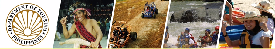
Other than its numerous tourism potentials, Surigao has one of the Philippines’ most colorful ethnic tribes; the Mamanwas. Their dances are showcased in a local festival called as “Bonok-Bonok”, held on the occasion of the feast of San Nicolas de Toletino which is observed annually every September 10.
The “Bonok-Bonok” depicts the native folks’ merry-making to show gratitude to their pagan gods for a bountiful harvest and good health.
The province is also working for the preservation of cultural artifacts. A collection of ancient archaeological diggings like burial coffins jars and antique Chines kitchen wares unearthed in Panhutungan, Placer is on public display at the Surigaonon Heritage Mini-Museum located at the Boulevard, Surigao City.
ENVIRONMENT AND NATURE
Mangrove is the major theme in the coastal areas of the province. The salt-water loving trees form interminable marine forests covering 17,473 hectares along the coasts of the mainland and the islands of Siargao and Dinagat. The province also boosts a variety of marine ecosystems like the lush seagrass beds and coral reefs which are relatively healthy and intact, supporting a rich diversity of marine flora and fauna.
Many who are interested in game fishing and spearfishing will enjoy its bountiful seas along the tuna route. Over 23 different species are caught the whole year round. Marlin, tuna, lapu-lapu, mollusks, crabs, even squids, stingrays and octopuses can be bought fresh and cheap from the fish vendors and fishermen.
The unique “mancono” (ironwood) forests of Dinagat are still one of the watersheds most productive resources. By its nature, it is a slow growing and adapted to a mineralized soil. It must be carefully managed for sustained productivity.
The province also has many caves and tunnels in its islands. Some are half-submerged in water most of the time and could be accessed only during low tides like the Suhoton Cave at Bucas Grande Island.
Its biggest islands are usually mountainous and rich in minerals. Nonoc Island has one of the world’s largest deposits of nickel, while Dinagat Island has major reserves of chromite. The smaller ones either rest on sand and gravel or have a limestone base bonded by boulders, reefs and sandbars. Some islets like those in Del Carmen in Siargao Island are actually nothing more than a cluster of rock formations jutting out from the sea crowned with shrubs and coconut trees. There are also springs, lagoons, caves, waterfalls, mangroves, marshes and whirlpools which are more appealing to all nature lovers.